Electra Surveying is a private engineering and surveying company, genuinely motivated by innovation, research work and system integration. Like a startup company Electra Surveying was establish in 2017 in Dubai UAE by Group of Geodetic & Civil Engineers. We now represent a group of talented individuals who collectively understand the importance of land surveying. As a very trend driven company we possess unique capabilities to quickly grasp new ideas and concept linked to Geospatial industries, collaborating every step of the way to achieve client’s goals and much more.
Land Surveying
Manpower and Equipment
Underground Utility Mapping
3D Laser Scanning & Modelling
Hydrographic Surveying
Aerial Data Collection
Mobile mapping 3D scanning
Hydrology Study and hydraulic modelling
P.M and Consultancy
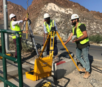
A Land Survey providing All type like ( Topographic Survey and Mapping – Demarcation Survey – As Built Survey – construction Survey – Establishment of Benchmarks – GPS and Static Survey – Settlement Survey – Volumes Calculations – Gate Level Survey )
Electra Surveying Engineering Company (ESE) is a legal provider of topographic surveying services in the UAE Region. Our experienced surveying staff and technical office are able to provide professional and reliable services in an efficient and timely manner. Client satisfaction is the top priority at Electra Engineering and Surveying Company. The field team are highly experienced surveyors and technicians who are directly supervising surveying activities at site. ESE Company continually strive to portray and exhibit a professional image, and work towards elevating the general public’s idea of a land surveyor. The ESE team is proud of what we do and who we are.
Utility Surveying
In the congested landscape of today’s increasingly complex utility infrastructure, the technician can be overwhelmed with the multitude of interwoven metallic and non-metallic utilities. Wouldn’t it be easier to see what’s underground without the cost and disruption of exploratory excavation? A truly portable and cost-effective Ground Penetrating Radar (GPR) system that gives cable and pipe surveyors worldwide the ability to see what’s underground.
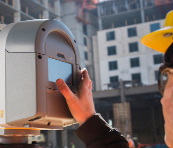
Terrestrial Scanning using Trimble TX8
ESE provides survey grade geo-referenced point cloud data at cost effective and expedited project deliverable timelines. Delivers range from point cloud data to completely vectored CAD files.
Hydrographic Surveying
Collect data relating to bodies of water, and may include the water depth, bottom contours and configuration, directions and velocity of current, heights and water stages, and the location of fixed objects for navigational purposes.
Photogrammetry method
Using Real Time Kinematic (TRK) and Post Processed Kinematic (PPK) Drone and Survey technology, we are able to carry out extremely accurate surveys and produce a comprehensive set of precise digital elevation model and custom land information solution.
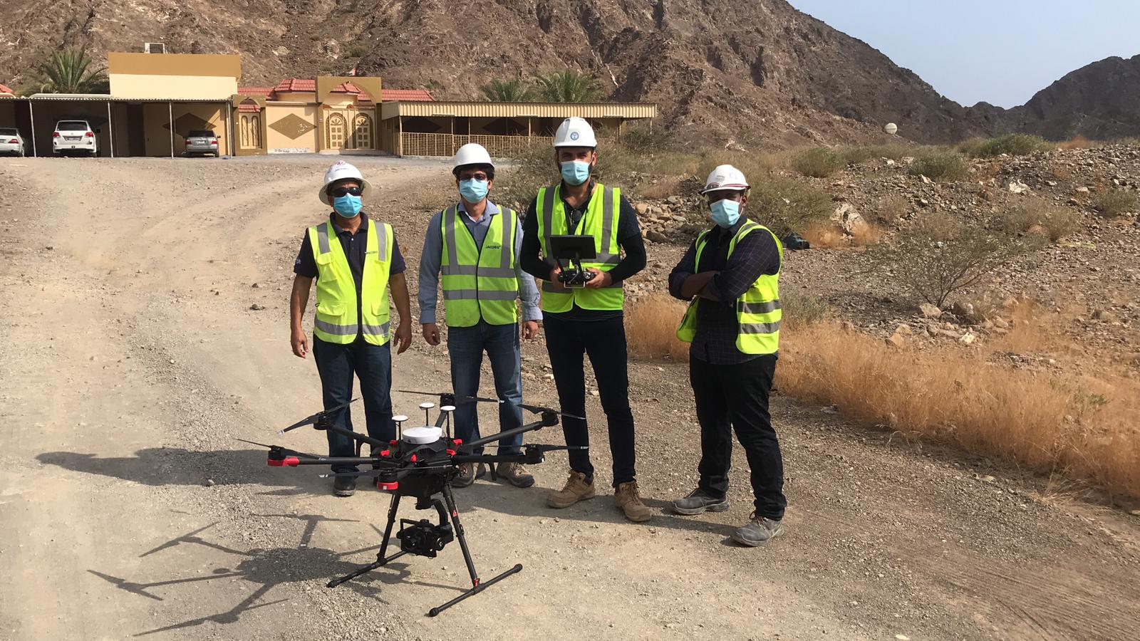
LiDAR Equipped UAV
ESE uses one of the most advanced tools in the commercial drone industry. LiDAR a remote sensing technology where sensors that are mounted to drones send a pulse from a laser to collect measurements, which can then be used to create very precise models (including 3D models) and maps of objects and environments within a short span of time thus covering a large area.
Trimble MX2 Mobile Mapping System
Mobile Mapping solutions bring together innovative software and high-tech scanning and visualization platforms in a mobile format that delivers fast, accurate and comprehensive understanding of environments. The Trimble MX2 is a vehicle-mounted spatial imaging system, offering significant operational flexibility for a wide range of applications such as highway planning and asset management or public safety and law enforcement projects.
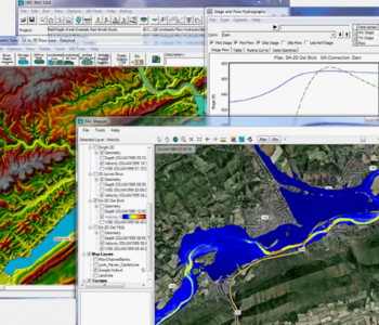
Hydrology Study and Hydraulic Modeling
ESE expertise is on the study hydrology of how water moves across and through the Earth’s crust, rain, snow, and other forms of precipitation impact river flows or groundwater levels, and how surface water and groundwater evaporate back into the atmosphere or eventually reach the oceans.
Hydraulic models can illustrate the effects of changing conditions of a system, and, among other things, display information about pipes, pumps, valves, flow, pressure, water quality and more, shown in software platforms using color-coded network maps, data tables and graphs.
To ensure order in the physical world around us
Surveying plays an integral role in land development, from planning & design of land subdivision to the final construction of roads & utilities and landscaping. ESE wants to ensure that all surveyors & technicians have visa.
We believe that surveyors are the first people on site, measuring and mapping the land, those primary measurements are used by architects to understand and make the most of the unique landscaping design.